|
|
|
Geomagnetic |
Magnetic Noon |
||
|
|
|
|
|
||
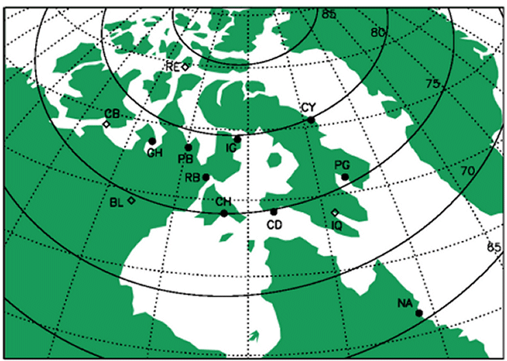
| Nain (NAN) |
|
|
|
|
|
| Pangnirtung (PGG) |
|
|
|
|
|
| Clyde River (CRV) |
|
|
|
|
|
| Iqaluit (IQA) * |
|
|
|
|
|
| Cape Dorset (CDR) |
|
|
|
|
|
| Igloolik (IGL) |
|
|
|
|
|
| Coral Harbour (CHB) |
|
|
|
|
|
| Repulse Bay (RBY) |
|
|
|
|
|
| Pelly Bay (PEB) |
|
|
|
|
|
| Baker Lake (BLC) * |
|
|
|
|
|
| Gjoa Haven (GJO) |
|
|
|
|
|
| Resolute Bay (RES) * |
|
|
|
|
|
| Cambridge Bay (CBB) * |
69.1
|
255.0
|
76.9
|
310.6
|
19:51
|
*These stations are Canadian Magnetic Observatories operated by the Geomagnetism Unit of the Geological Survey of Canada. Because these data complement the MACCS data, they are available to the GEM community courtesy of the Geological Survey of Canada and may be obtained by contacting either Dr. Mark Engebretson engebret@augsburg.edu or Dr. W. J. Hughes hughes@bu.edu.